Drone mapping for construction

Drone maps your clients will actually open.

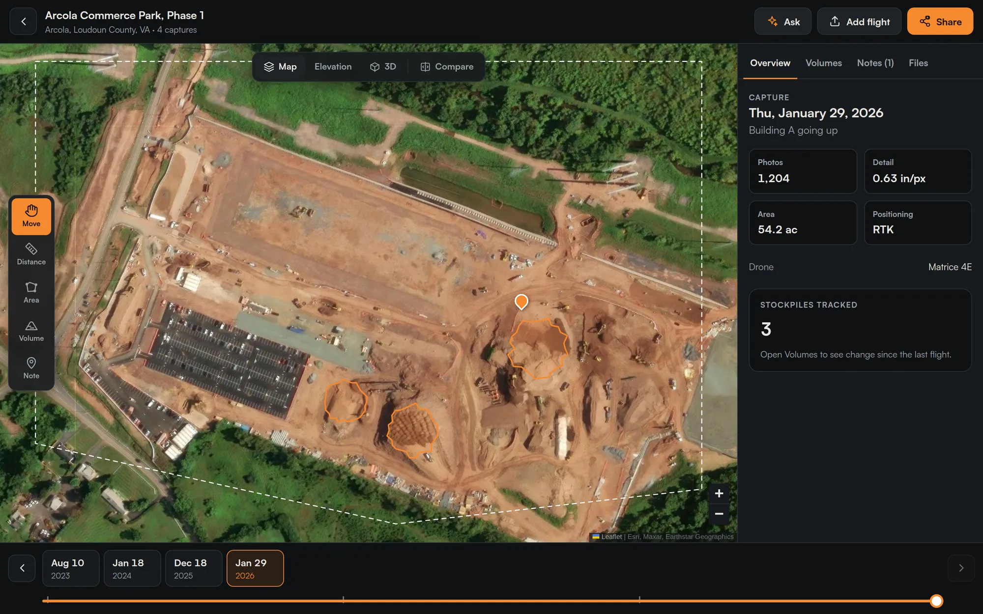
Upload a Mavic 3 Enterprise or Matrice 4 flight. Get a 2D map, elevation, a 3D model, stockpile volumes and cut/fill, then slide through every capture date to see progress.

Clients view freeWorks on any phonePlans from $99/mo
capturedmaps.com
Captured Maps site view: aerial map of Arcola Commerce Park with stockpiles outlined, capture details panel and a timeline of four flight dates
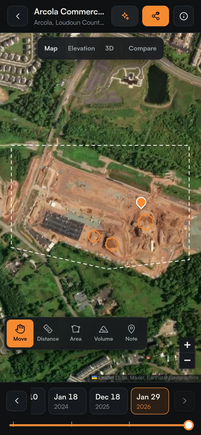
The same site open on a phone
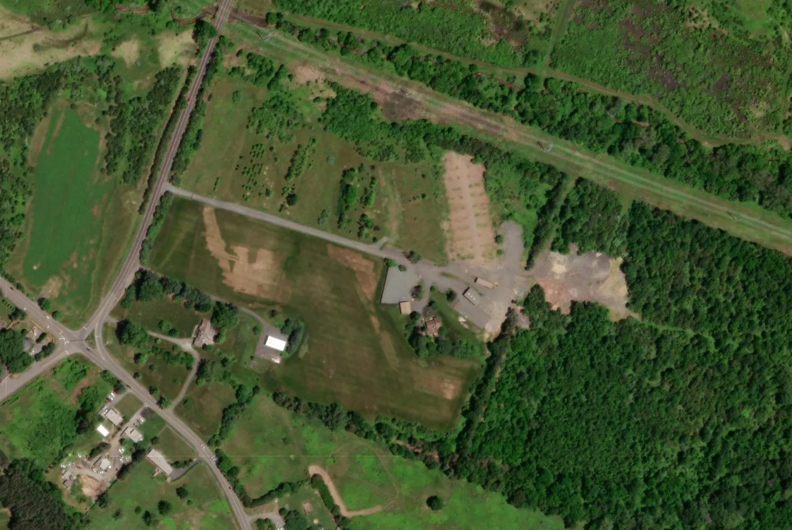
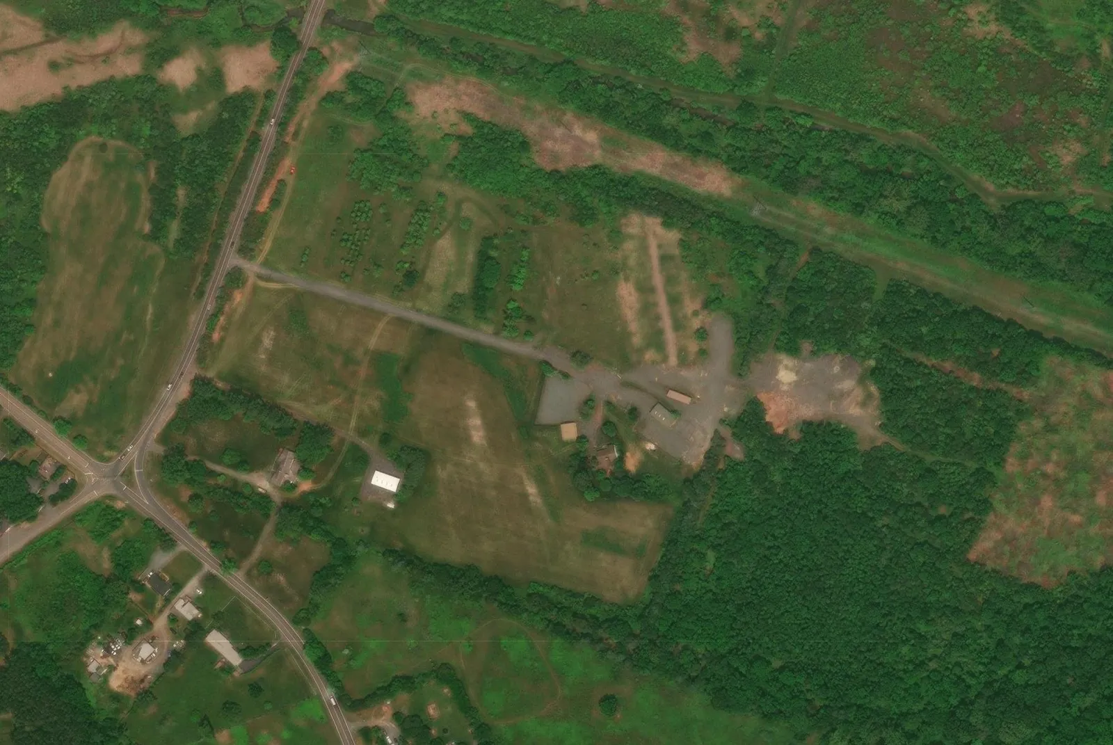
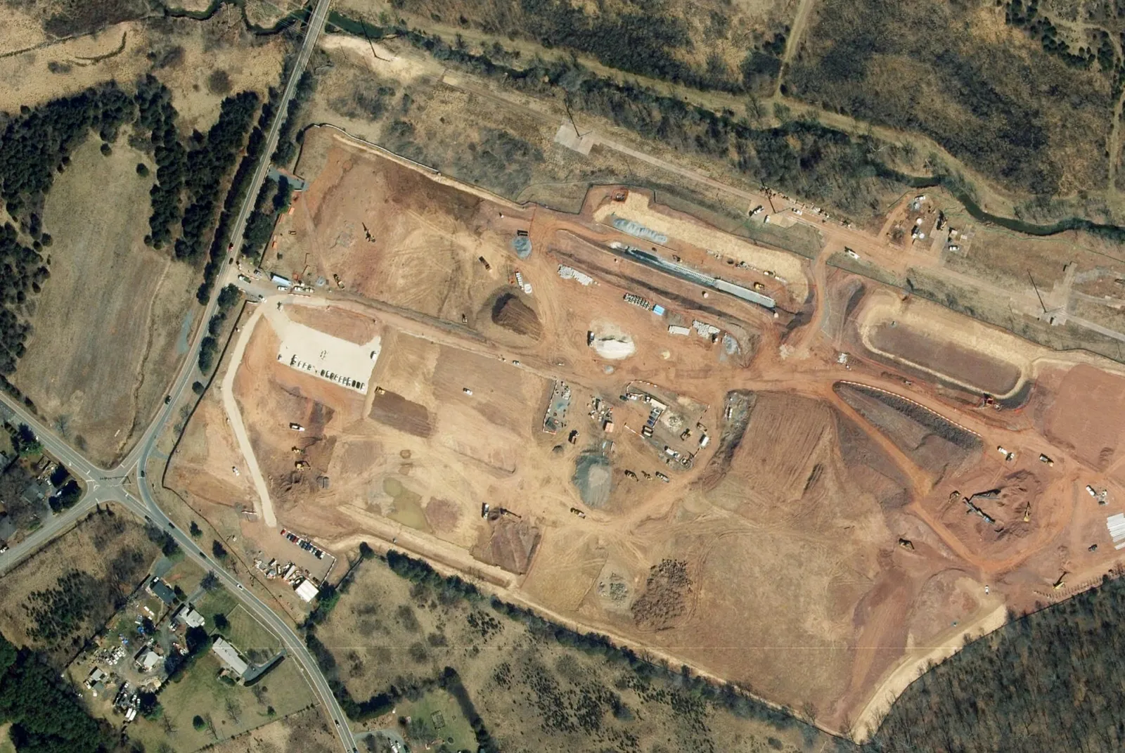
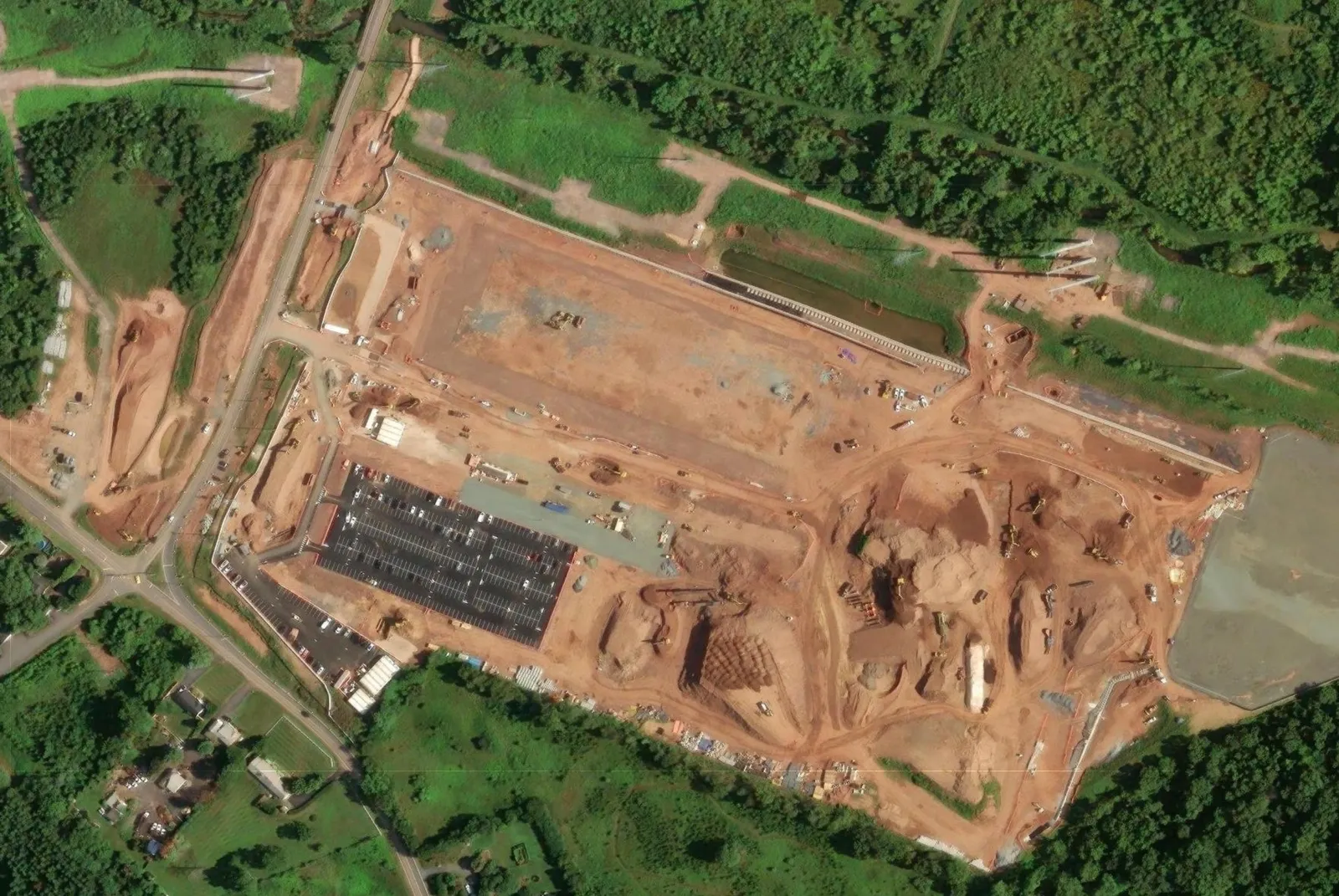
August 2023: wooded farmland before clearing January 2024: site staked December 2025: mass grading underway January 2026: Building A going up, parking lot paved
Aug 10, 2023Before clearing
Capture timeline

Every flight on one timeline.

Drag the slider. That's how your clients see their job: from cleared land to a building pad, one date at a time.

  • Before and after split view between any two flights
  • Notes and pins tied to the date they were made
  • Stockpile change and cut/fill since the last flight

Demo site: Arcola Commerce Park, Loudoun County, VA. The demo uses Esri World Imagery Wayback satellite archive imagery (dates approximate). Your maps come from your own drone flights.

How it works

Plan it. Fly it. Send it.

Built around how pilots already work in DJI Pilot 2. No new hardware, no desktop software.

01 / PLAN

Draw the site, download the flight

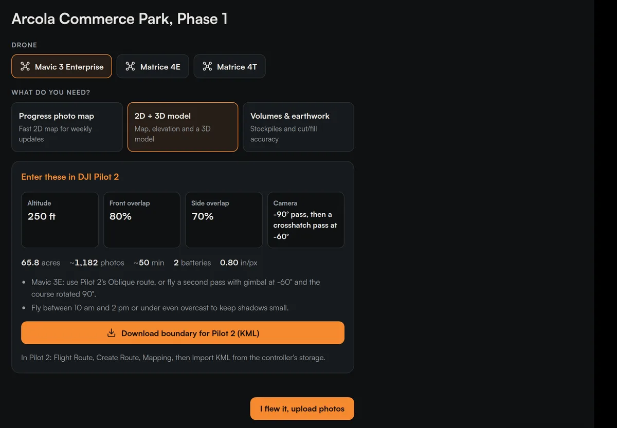
Draw the boundary, pick your drone and what the client needs. Captured Maps sets altitude, overlap and camera angle, and hands you a KML for DJI Pilot 2.

  • Mavic 3 Enterprise, Matrice 4E and 4T
  • Progress map, 2D + 3D, or volumes presets
  • Acres, photo count, flight time and batteries up front
Flight plan screen showing drone choice, mapping presets and DJI Pilot 2 settings: 250 ft altitude, 80% front overlap, 70% side overlap
02 / FLY AND UPLOAD

Pick the folder. We check every photo.

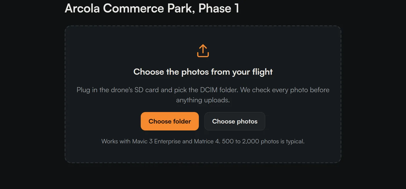
Plug in the SD card and choose the DCIM folder. Before anything uploads, each photo is checked so a bad card doesn't cost you a trip back to the site.

  • GPS, camera, RTK, date and overlap checks
  • Uploads straight to storage, 500 to 2,000 photos is typical
  • Watch each processing stage as it runs
Upload screen: choose the photos from your flight, with buttons to choose a folder or photos
03 / SHARE

Your client gets a link, not a file

Invite clients by email with view or edit roles, or send a view-only link. They get an email when a new capture is ready and open it on a phone or computer.

  • Every site, capture and client in one dashboard
  • Clients view free, unlimited
  • Installs to the home screen like an app
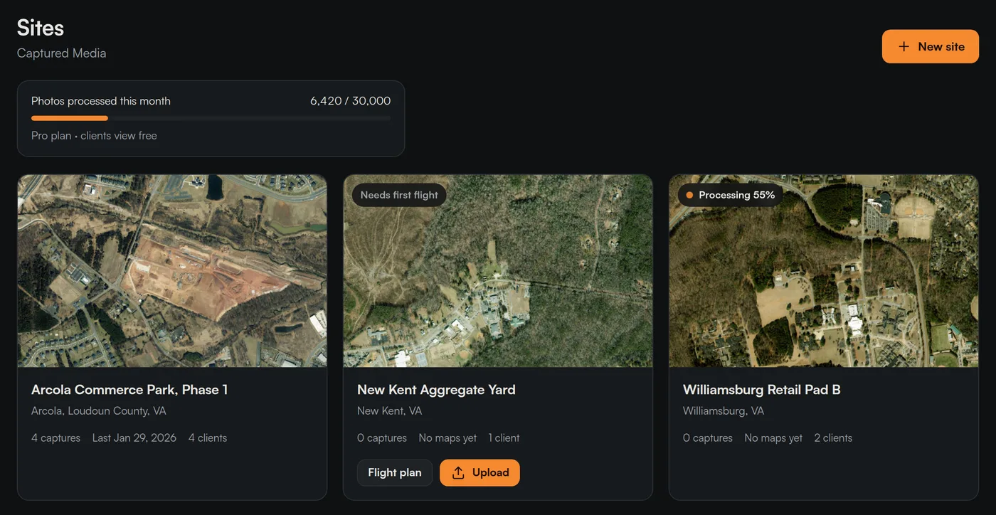
Sites dashboard showing three construction sites with capture counts, client counts and processing status
What every flight gives you

The numbers the site actually asks for.

Stockpile volumes

Trace a pile. Get cubic yards, tons by material, footprint and height, with four ways to set the base. See how much it moved since the last flight.
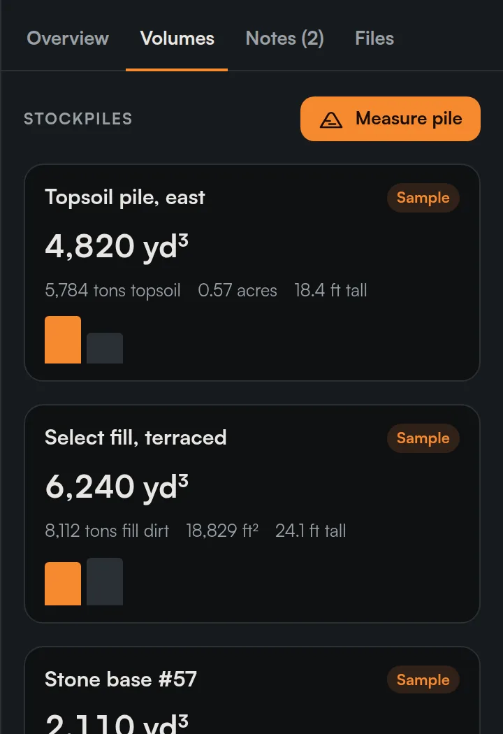

Volumes panel listing a topsoil pile at 4,820 cubic yards, select fill at 6,240 cubic yards and a stone base pile

Before and after

Split the map between two flights and drag the line across the site.
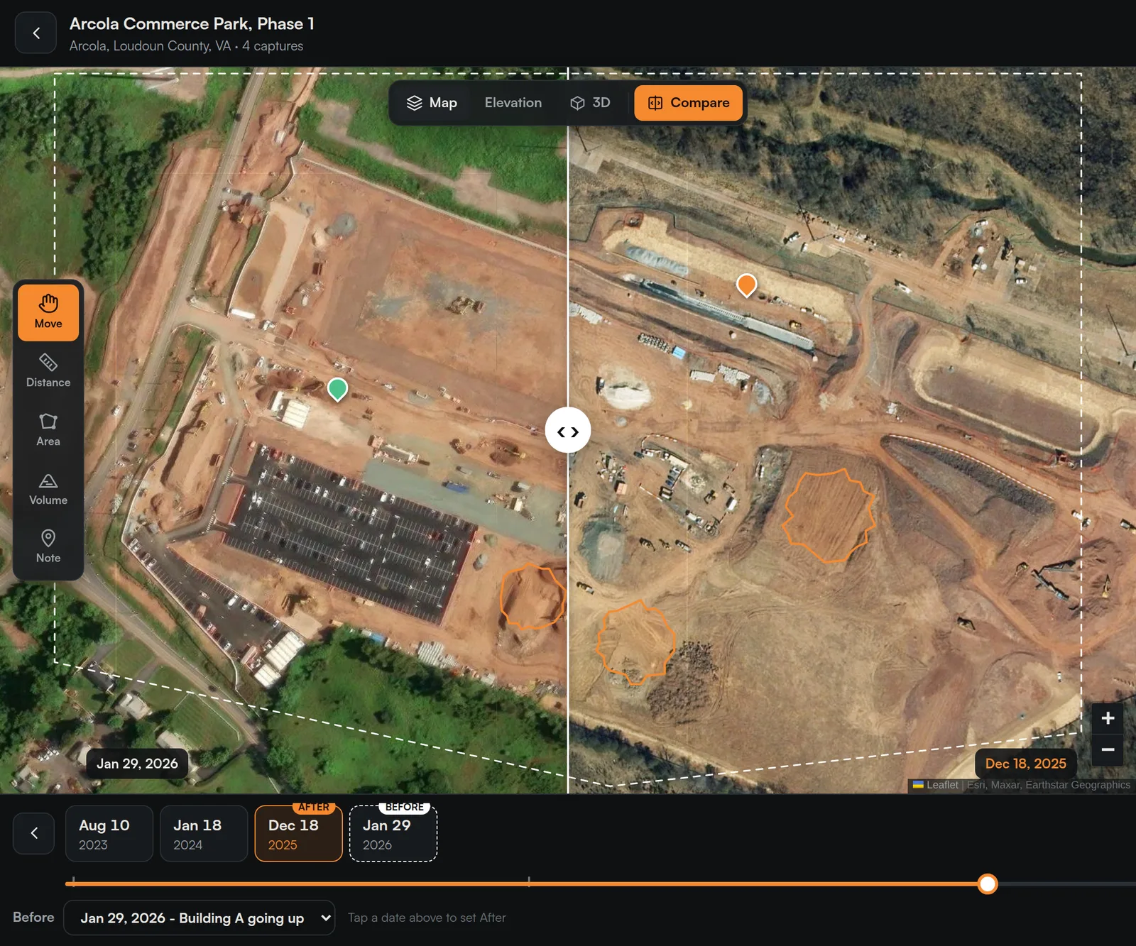
Compare view splitting the map between January 2026 and December 2025

Cut and fill

See what was cut and filled between two flights, or grade against a target elevation.

2D, elevation and 3D

Sharp aerial map, height colors with contours, and a 3D model you can spin.

Notes on the map

Pin an issue where it is, like "silt fence down along north swale", then mark it resolved.

Atlas, the assistant

It sees the map you're looking at and can switch views, compare flights or open sharing for you.

What changed since the last flight?Show me the stone pile

Screens from the Captured Maps demo workspace. Volume figures shown are sample values.

Two sides, one map

Built for the pilot. Easy for the client.

For pilots

Less office time per flight

  • Flight plan and KML ready before you leave the truck
  • Photo checks catch a bad flight before you drive away
  • Volumes and cut/fill without separate processing software
  • Your logo and colors on the client view (Pro, coming soon)
For your clients

Nothing to install, nothing to learn

  • Open a link on a phone and see the whole site
  • An email when the new flight is ready
  • Measure a distance or area right on the map
  • Free and unlimited, for every client you invite
Pricing

Simple plans. Clients always free.

Every plan includes 2D, elevation, 3D, volumes, cut/fill and the timeline.

Solo $99/mo

One pilot running their own sites.

  • 1 pilot
  • 10,000 photos a month
  • 2D, 3D, volumes, cut/fill, timeline
Get early access
Most popular Pro $249/mo

Small teams delivering to contractors.

  • 3 pilots
  • 30,000 photos a month
  • Your logo and colors Soon
  • PDF progress reports Soon
  • Cut/fill against a design surface Soon
Get early access
Business $599/mo

Drone programs with multiple crews.

  • 10 pilots
  • 100,000 photos a month
  • Priority processing
  • API access Soon
Talk to us
Pay per map $49/map

One-off jobs, no subscription.

  • Up to 1,500 photos
  • Full map, 3D and volumes
  • Share with your client free
Get early access
Annual billing: 2 months free Extra photos: $5 per 1,000 Clients: view free, unlimited

Need the site flown too?

Captured Media flies construction sites across Virginia and delivers straight into Captured Maps. Quoted per job.

Get a flight quote
Questions

Straight answers.

Something else? Email hello@capturedmaps.com.

Which drones work with Captured Maps?

DJI Mavic 3 Enterprise and Matrice 4 (4E and 4T). Flight plans and photo checks are built for both.

Do my clients have to pay or make an account?

Clients view free and unlimited. Invite them by email to sign in with a one-time code, or send a view-only link that opens without signing in.

Do I need RTK?

RTK gives the best accuracy and is what we recommend today. The upload check tells you whether RTK was on for every photo. Support for ground control points on non-RTK flights is on the roadmap.

How many photos can one map have?

Most sites run 500 to 2,000 photos. Your plan includes a monthly photo allowance, and extra photos are $5 per 1,000. Pay per map covers up to 1,500 photos.

Does it work on a phone?

Yes. Captured Maps runs in the browser and can be added to the home screen on iPhone and Android, so it opens like an app.

Can you fly the site for me?

Yes. Captured Media flies sites across Virginia and delivers into Captured Maps. Those jobs are quoted separately.

Captured Maps

Put every flight on the map.

Get early access and map your next site with us.